Viewshed, view corridor, and what actually drives the cost of a shoot
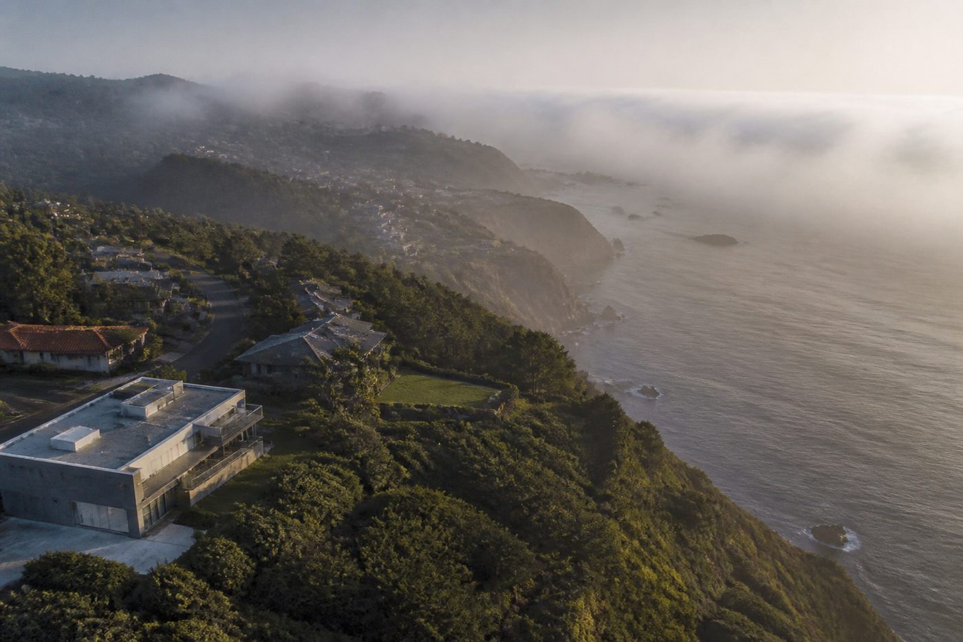
A viewshed is a computed surface, not a word for a nice outlook. Reading one properly tells you how many camera stations a job needs, at what elevations, and therefore why two aerial commissions at the same height can differ in effort several times over.
In geographic information systems, a viewshed is the set of all locations that are visible from a given observation point. It is computed by tracing a line of sight from that point to every cell of an elevation raster and asking whether anything in between rises above the line. The output is binary: each cell is visible or it is not. Everything else about the analysis is a question of what you fed into it.
That last point is where most disagreements start. A viewshed computed on a bare earth terrain model sees through buildings and trees, because they are not in the model. One computed on a digital surface model, which includes everything the sensor saw, gives an answer that looks nothing like it in a city.1 Neither is wrong; they answer different questions. Anyone quoting a viewshed should say which surface it was computed on.
- Viewshed
- Everything visible from one point, computed on an elevation model
- View corridor
- A sightline protected by zoning, not by geometry
- Observer offset
- Eye height added above the model surface
- Horizon at 200 ft
- About seventeen miles over a smooth earth
The four parameters that change the answer
A viewshed is only as meaningful as its parameters, and there are four that matter more than the rest.
- Observer offset. The height added above the model surface at the observation point. For a view study this is the eye height above the finished floor, not the floor elevation itself.
- Target offset. The height added at every other cell. Set it to zero and you are asking what ground is visible. Set it to twelve metres and you are asking what rooftops are visible, which is a different map.
- Radius. An unbounded viewshed will happily report visibility at fifty miles, where nothing is legible to a camera or an eye.
- Curvature and refraction. Over any distance worth analysing, the earth curves away and the atmosphere bends light back down. Analyses that correct for both typically apply a refraction coefficient of around 0.13.2
The curvature term is not academic at the heights this site is about. Over a smooth earth, the geometric distance to the horizon in statute miles is roughly 1.22 times the square root of the eye height in feet.3
| Eye height | Horizon | In kilometres | Roughly |
|---|---|---|---|
| 6 ft | 3.0 miles | 4.8 km | Standing on flat ground |
| 50 ft | 8.6 miles | 13.9 km | Top of a mast |
| 100 ft | 12.2 miles | 19.6 km | Tenth floor |
| 200 ft | 17.3 miles | 27.8 km | Working height of a tethered platform |
| 400 ft | 24.4 miles | 39.3 km | Drone ceiling |
| 500 ft | 27.3 miles | 43.9 km | Moored balloon ceiling |
Adding atmospheric refraction extends each of those figures by something like eight per cent. In a real landscape none of it survives contact with the first hill, which is exactly why the computed viewshed is worth having.
A viewshed tells you where you could be seen from. It says nothing at all about whether anything there is worth photographing.
The limit of the analysis
View corridors are legal objects, not geometric ones
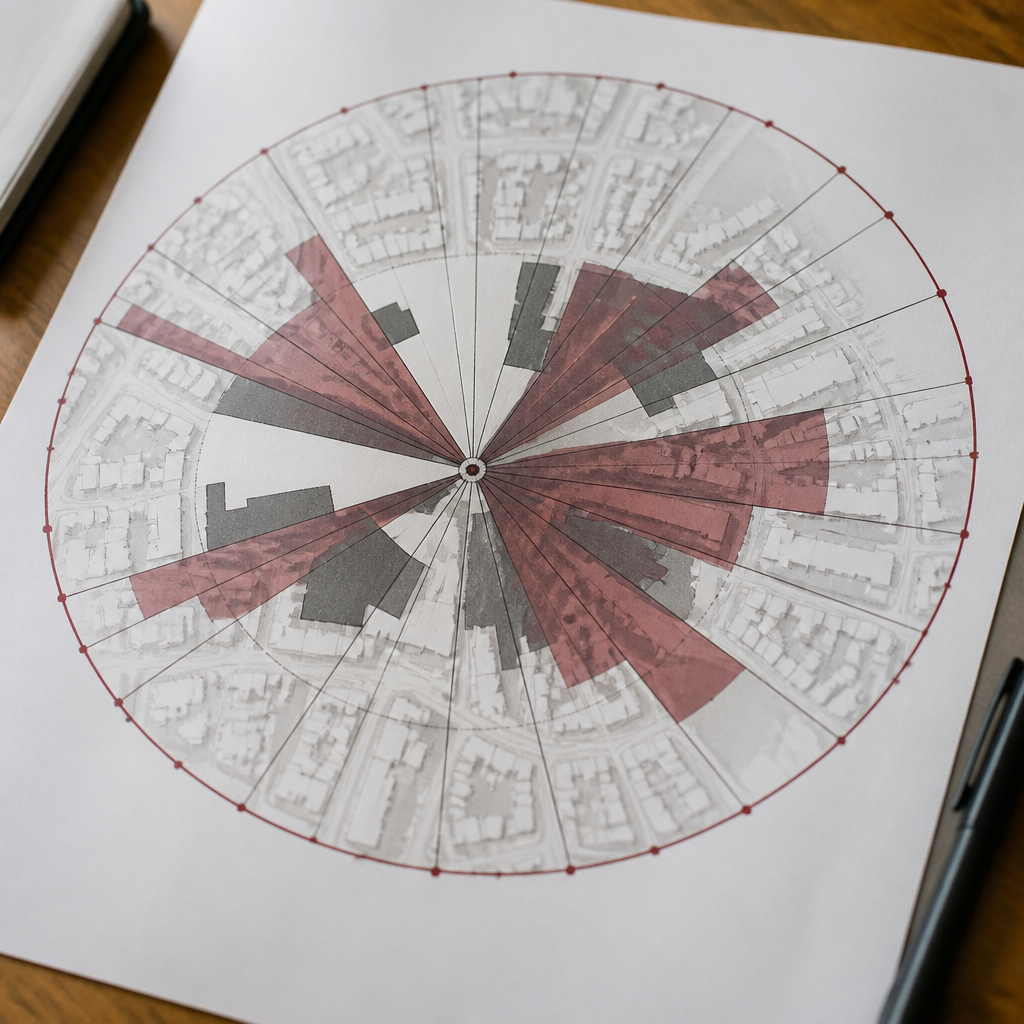
A view corridor, sometimes called a view cone, is a sightline that a municipality has decided to protect, usually by restricting building heights within a mapped wedge of land. Vancouver in British Columbia is the best known North American example, and a number of other cities operate comparable protections under different names.4
The distinction matters when a client uses the two words interchangeably. A viewshed is what physics allows today. A view corridor is what an ordinance protects tomorrow. A development can sit entirely inside a beautiful viewshed and lose the whole thing to a neighbour building within their own entitlement, which is the point made at more length in the page on preconstruction view studies.
What actually drives the effort in an aerial job
Once the viewshed is drawn, the shoot plan follows from it: how many observation points are needed to cover the question, and what elevation each one has to reach. That is the honest basis for scoping the work, and it explains why height alone is a poor predictor of effort. The following are the variables that multiply it. None of them are prices, and this site quotes none.
| Driver | Why it multiplies |
|---|---|
| Number of stations | Each observation point is a separate setup, and on a tethered platform a separate inflation cycle if the anchor cannot be walked |
| Elevation required | Decides the platform, and above four hundred feet decides the regulatory regime too |
| Airspace class | Controlled airspace means authorisation, and near an airport it may mean the job cannot be done at all with a tethered platform |
| Ground access | Permission, escorts, road closures and the clear area required beneath any platform |
| Light window | A twenty minute twilight window costs a full mobilisation per frame |
| Weather dependency | Wind limits on a tethered platform turn one visit into three |
| Documentation level | Survey control and full metadata capture are a different job from taking pictures |
| Deliverable format | Raw frames, corrected images, montage ready plates and measured orthomosaics are four products, not one |
Notes
- Digital terrain model: bare earth. Digital surface model: earth plus buildings and vegetation as captured. A viewshed inherits every limitation of whichever it was run on, including the date the data was collected. Back
- A refractivity coefficient of 0.13 is the common default in mainstream viewshed tools, representing average atmospheric bending of light near the surface. Back
- Geometric horizon distance is the square root of twice the earth radius times the eye height. In practical units, distance in statute miles is about 1.22 times the square root of the height in feet, or distance in kilometres is about 3.57 times the square root of the height in metres. Back
- Vancouver protects designated view cones through its zoning, limiting building heights inside mapped wedges. Comparable mechanisms exist elsewhere under names such as view corridor, scenic easement or height overlay. Back